
by Wendy S. Myer
Daily, each of us is faced with the question of what type of clothing to wear--should it be a sweatshirt and jeans or a tanktop and shorts? Many of us rely on weather forecasters to aid in this decision process; however, should we be relying on them?
The future state of the weather is uncertain and no one knows with 100W accuracy what the weather will actually be. But with improvements in computer and satellite technology, especially over the last twenty-five years, it seems feasible to assume that weather forecasters' predictions of the probability distribution of daily temperatures are becoming more and more accurate. Is it correct to assume this? In other words, have weather forecasters improved in predicting the actual high and low temperatures over the last twenty-five years? This is the main focus of this study; however, a second question to consider is, given the seasonal variations, does the accuracy of weather forecasting vary depending on the season? That is, is it easier to predict warm or cold temperatures?
Each day, the air goes through a cycle of heating and cooling. In the morning hours, as the sun rises and thus increases its solar ray intensity, the air warms. Then, after
peaking around noon, as the sun begins to set and thus begins to decrease its solar ray intensity, the air cools. The air continues to cool after the sun has set due to the transfer of energy from the ground to the air. [1] As the night progresses, the air continues to cool until it reaches its minimum just before the sun rises. The cycle then begins again.
The actual variability of how warm or cold the air gets depends on many factors. The greatest factor in determining the air temperature is the amount of solar radiation that reaches the surface--that is, the input of energy from the sun and the output of energy from the surface. [2] This is determined by the amount of daylight hours and the intensity of solar radiation both of which vary according to the season. In addition to this, there are four main controls which cause variation in air temperature- latitude, land and water, ocean currents, and elevation. [3]
Weather forecasters must consider these variations as well as the amount of solar radiation that reaches the earth surface when they make their probability distributions which are based in part on human judgment. [4] However, weather forecasters also use satellites and supercomputers.
Meteorological satellites originated in the 1960s and since then, a considerable amount of research has been directed towards the design of spaceborn meteorological sensors. [5]
After simulation studies, it was concluded that substantial improvements in the accuracy of numerical weather forecasts should be made using assimilated satellite- derived temperature profiles. [6] After the study conducted by Atlas et al., it was further concluded that satellite data has made significant contributions toward improving weather forecasting. [7]
Supercomputers, having become more and more powerful in recent years, have also contributed to improving weather forecasting. [8] With these computers, which use satellitederived surface temperatures, it is possible to run prediction models with increasingly finer resolution. In other words, Kapitza suggests that as the supercomputers continue to improve in resolution, weather prediction will improve in accuracy. [9]
Many factors needed to be considered in determining the best method to show whether or not weather forecasters have improved in predicting daily temperatures and if their accuracy shows seasonal variability.
First, using a table of random digits, a simple random sample of three dates per season--Spring, Summer, Fall, and Winter--was taken for three sets of five years--1970-4, 1980-4, and 1990-4. [10] These same dates were then repeated for each of the five-year cycles, i.e. April 1, 1970, April 1, 1980, and April 1, 1990.[1l]
Second, using the Los Angeles Times, a sample of fifteen United States cities were chosen. (Table 1) These cities reflected variations in latitude, land and water influence, ocean current influence, and elevation. For each of these cities, the Times reported both the predicted and actual high and low temperatures on a daily basis using the data given to it by the U.S. Weather Bureau. When the Times began reporting the predictions for only western U.S. cities, a switch was made to the Minneapolis Tribune which in 1982 became the Minneapolis Star and Tribune. This paper was chosen because like the Times, it was a morning paper and reported predictions for the following day. [12] Unfortunately, the Minneapolis Tribune used reports given to it by the National Weather Service instead of the U.S. Weather Bureau.[13]
Third, using microfilm from the two newspapers, the historical data of predicted and actual high and low temperatures were recorded in degrees Fahrenheit for each date and each city. [14] (See Appendix A for form used) Next, the difference between the two figures were recorded. [15] Thus, the total observation set, n, was 5,269. From this data, first, the mean of the differences was calculated for the individual seasons and second, the mean was calculated for the individual years. These means were then graphed as a time series to show the results.
Table 1
United States Cities
1. San Francisco
2. Portland
3. Seattle
4. Las Vegas
5. Salt Lake City
6. New York
7. Boston
8. Washington, DC
9. Maiami
10. Detroit
11. Chicago
12. Kansas City
13. New Orleans
14. Houston
15. Milwaukee
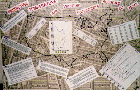
The results are displayed in the following tables and graphs. First, Table 2 shows the calculated yearly means. Graph 1, superimposing each five-year span on one graph, visually presents this same data as a time series.
Second, Table 3 shows the calculated seasonal means for each year. Graph 2, also superimposing each five-year span on the same graph, visually presents this data as a time series.


Using Graphs 1 and 2, two significant conclusions can be drawn. First, Graph 1 reveals that over the total twenty- five year time span, the mean difference has dropped. In other words, weather forecasters are becoming more accurate in predicting the actual high and low daily temperatures. This is most likely the result of the combination of the introduction of meteorological satellites and the increasingly finer resolution of supercomputers.
Second, Graph 2 reveals that the accuracy of weather forecasting does vary according to the season. Looking at this graph, seasonal trends are evident. The weather forecasters tend to be most accurate during summer while they tend to be least accurate during fall and winter. From this, it can be concluded that warmer temperatures are easier to predict than colder temperatures.
Although weather forecasters are not 100W accurate, they are becoming more reliable in predicting a probability distribution of high and low daily temperatures. Thus, each morning when faced with the question of what type of clothing to wear, we must first consider the season but can be comforted by the fact that the weather forecasters are more accurate than they were twenty-five years ago.
During the process of conducting this study, I have learned much. First, the sample size of three dates per season may have been too small to make my conclusions completely valid; however, given the twenty-five year time span this size seemed the most manageable.
Second, the time span seemed to be appropriate to show the improvements made in weather forecasting but by using this broad time span, some outside factors interfered. First, the Los Angeles Times did not consistently report the predicted and actual high and low temperatures for the entire time span thus I had to switch, in 1974, to the Minneapolis Tribune ( It later became the Minneapolis Star and Tribune.) which had not reported the predicted high and low temperatures in 1970 when I began recording the data. Second, because of the strike of the Tribune in the fall of 1980 where papers were published sporadically, I was forced to change one of my dates to the first following date where consecutive newspapers were published. To account for such difficulties in another study, I would begin by looking at randomly chosen dates throughout the time span, before actually recording the historical data, in order to find a newspaper that consistently reports the needed data. After this, I would then do a little research on the newspaper itself to see if it was consistently published.
Third, the results presented in Graph 1 appear almost too perfect. I would suggest for future studies such as this that two separate studies be conducted and then compared. This would most likely make the results appear more reliable.
Although I felt I had considered all the factors, I found through the process of completing my project, there were some I
overlooked. I am not clear whether these factors have influenced the results of my study or not, but if I were conducting this study again or if a future student were going to conduct this same study, these factors--sample size, choice of newspaper, and number of studies--should be considered.
References
Ahrens, C. Donald. Meteorology Today: An Introduction to Weather, Climate, and the Environment. 5th ed. Minneapolis/St. Paul: West Publishing, 1994.
Atlas, R., E. Kalnay, and M. Halem. "Impact of satellite temperature sounding and wind data on numerical weather prediction." Optical Engineering. 24 (Mar/Apr 1985): 3416.
Kapitza, Hartmut. "Numerical Experiments with the Adjoint of a Nonhydrostatic Mesoscale Model." Monthly Weather Review. 119 (Dec. 1991): 2993-3011.
Miller, Robert G. "The Probability of Rain." Statistics: A Guide to the Unknown. 2nd ed. Judith M. Tanur, et al., eds. San Francisco: Holden-Day, 1978: 436-49.
Footnote
[1] C. Donald Ahrens, Meteorology Today: An Introduction to Weather,
Climate, and the Environment, 5th ed. (Minneapolis/St. Paul: West
Publishing, 1994) 66-8. The ground and air nighttime cooling process is called
radiational cooling. Because the ground is a better radiator, it cools faster
than the air and therefore it transfers energy to the air directly above
causing it to cool.
[2] Ahrens, 72.
[3] Ahrens, 72.
[4] Robert G. Miller, "The Probability of Rain," Statistics: A Guide to the
Unknown, 2nd ed., eds. Judith M. Tanur, et al., (San Francisco: Holden Day,
1978) 437.
[5] R. Atlas, E. Kalnay, and M. Halem, "Impact of satellite temperature
sounding and wind data on numerical weather prediction," Optical
Engineering, 24 (Mar/Apr 1985): 341.
[6] Atlas et al., 341.
[7] Atlas et al., 3426.
[8] Hartmut Kapitza, "Numerical Experiments with the Adjoint of Nonhydrostatic
Mesoscale Model," Monthly Weather Review, 119 (Dew 1991): 2993.
[9] Kapitza, 2993.
[1O] For simplicity, the date of the winter season is recorded for the year in
which that winter started, i.e. Winter 1970-1 is recorded as Winter 1970 even
though the sample dates all fall in 1971.
[11] In some cases, such as during the strike of the Minneapolis Tribune
when the paper was published only sporadically, another date had to be
used. When this was the case, I chose the next date for which the predicted and
actual temperatures could be recorded.
[12] Other papers I looked at reported predictions for that day only.
[13] I looked at various other papers to try and continue with the same weather
service but was unable to locate one.